


If you’ve driven through Southeast Michigan, you’ve likely passed a street sign that reads "8 Mile," "9 Mile," or maybe you’ve cruised downtown to Campus Martius on Michigan Avenue.
They’re orderly, maybe even a little predictable, but the history of how they got there is anything but.
The "Mile Roads" tell a story of Detroit’s early urban planning history— as the city evolved from a small fort to a sprawling metropolis.
19th century
In 1805, the Great Fire destroyed almost all of Detroit, which, at that point, was composed of Fort Pontchartrain and a few other buildings. But that devastation created an opportunity for leaders and urban planners to build a new infrastructure from scratch.

Enter Judge Augustus Woodward.
The first Chief Justice of the Michigan Territory, Judge Woodward arrived in Detroit just days after the fire. Luckily, he had a plan for a new street layout. His plan resembled the spoke-and-wheel style streets of Washington D.C.—the city he lived in before coming to Detroit.
Part of this planning included a task that any land surveyor must complete: establishing a "point of origin," or a physical marker of where a land survey begins.
“After the Great Fire, there was a marker laid down in Campus Martius known as the point of origin, which had been lost for many years,” said Jeff Horner, professor in the Department of Urban Studies and Planning at Wayne State University. “And then, about 30 years ago, when they were building Campus Martius, some worker hit it with his equipment and they found this big granite monolith.”
Today, you can see the small metal marker in the ground that commemorates the point.
The line established by the point of origin, where Woodward meets Michigan Ave, would later become "Zero Mile." Detroit was becoming increasingly populated at this time, however, and Woodward’s street design was no longer conducive to the division of the land into allotments.
City leaders decided to forego the spoke and wheel design, and opted for simple rectangles. But the survey lines that started with Woodward’s plan became the blueprint for the system that would shape the streetscape of metro Detroit more than a century later.
20th century
The early 20th century brought exponential growth to the city’s population, and new concepts for transportation surfaced.
In 1924, the Rapid Transit Commission came along with a vision for high speed trains running to and from the city. These trains would have run underneath the city streets of Detroit—yes, subways—and then run above ground when they reached the suburbs. Engineers envisioned extra wide streets to accommodate aboveground trains and automobiles.

But this never happened. The "master plan" fell through in part because the stock market crash of 1929 left the city without funds for the project.
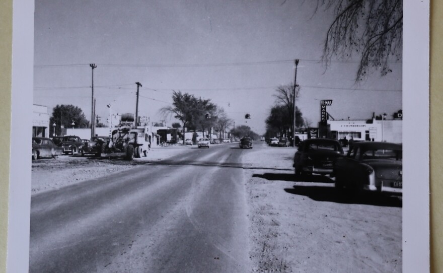
Though the super highway plan never made it off the ground—or rather, below the ground—Detroit ended up with extra wide roads like Gratiot, Grand Boulevard, Outer Drive, and the Mile Roads!
Detroit is also credited with the first mile of paved road in the country: between 6 Mile and 7 Mile road.
Becoming cultural shorthand
The Mile Roads are more than just a memorable aspect of metro Detroit’s street plan. They have also become markers of the city’s culture.
The onset of the automobile industry brought an influx of immigrants and southern Black Americans to Detroit during the Great Migration.
Racial restrictive covenants were included in property deeds—clauses that prohibited non-white people from buying said property. This limited Detroit’s Black population to small sections of the city. One of the largest and well-known of these neighborhoods, Black Bottom, was destroyed and replaced with a freeway in the late 1950s and early 1960s.
The Mile Roads are part of the city’s history of racial redlining, too.


The phrase "Hitting 8 Mile" is more than just an informal way of giving directions. It signals a crossing over from the majority-Black city of Detroit into the predominantly white suburbs, or vice versa.
“The Mile Roads, particularly Eight Mile, which leaves the city of Detroit, become ways of understanding where a Black person can buy, rent or lease,” said Jamon Jordan, lecturer in the U of M Residential College and founder of the Black Scroll Network.
In this episode of On Hand, we get to the bottom of why metro Detroit has these roads, and how they’ve become cultural symbols of the city and its suburbs. Hear the full story above.
GUESTS:
- Jeff Horner, Professor of Teaching in the Department of Urban Studies and Planning at Wayne State University
- Jamon Jordan, Lecturer in the U of M Residential College, founder of the Black Scroll Network
- Paul Sewick, amateur Detroit historian and part-time Lyft driver. Check out his blog Detroit Urbanism here.
Want to submit a question to On Hand? Do it here:
- Online Submission Form
- Call us: 734-764-7840
- Email us: onhand@michiganpublic.org
If you like what you hear on the pod, consider supporting our work: michiganpublic.org/podfund


