


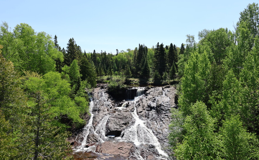
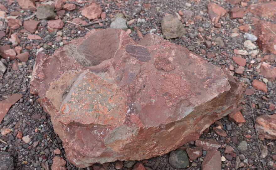
Michigan's Upper Peninsula might not be the first spot you think of when someone says "volcano" — but maybe it should be.
Erika Vye, a geosciences research scientist at the Great Lakes Research Center at Michigan Tech, said that people are often surprised when she tells them that Michigan is, in fact, home to one of the largest lava flows by volume on earth.
“Is it active? No. But definitely we have visible signs of of where this volcano is and where you can see it.”

"It's a series, like we say, that ridge and valley topography. But you could argue that the Greenstone is sort of the pièce de résistance or the the jewel in the crown," said Erika Vye, a geosciences research scientist at the Great Lakes Research Center at Michigan Tech.
That's right, the peaceful shores of Lake Superior were once a roiling sea of lava. Around 1.1 billion years ago, a rift volcano erupted from the earth’s crust, producing massive amounts of lava that formed the geological foundation of the U.P. we know and love today. Just how massive you ask?
“Fifteen hundred cubic miles of lava,” explained Vye. “So if you filled 2.5 billion Olympic-size swimming pools, that’s the volume of material we’re talking about.”
Rift, interrupted
This huge geological event formed what's known as the Midcontinent Rift System, and it lasted for millions of years. The full rift actually extends in two arms from the Keweenaw Peninsula. One arm reaches at least as far as the southeast corner of Michigan. The other arm extends all the way down into Kansas.

Rift events like this one often split continents apart. The Midcontinent Rift System was near the middle of the massive ancient supercontinent Rodinia in a region geologists call Laurentia (the land mass that makes up modern North America). So why does Michigan sit in the middle of the Great Lakes instead of at the bottom of an ocean?
“That's you know it's this is still debated in geology, but there are some major mountain-building events that were happening at the same time as Laurentia or Rodinia was trying to split itself apart,” explained Daniel J. Lizzadro-McPherson, a geospatial research scientist at Michigan Tech. “And so one of those is the Grenville Orogeny. … Those are built being built up like the Himalayas, huge, huge mountains under compression, thrusting these rocks up. That compression is what stopped the extension of the rift.”

Most of the evidence of volcanic activity along the Midcontinent Rift System is deep underground and invisible to the humans above — but that’s not the case in the Keweenaw Peninsula. As the lava flow cooled, air bubbles rose up to the top of the flow creating a “frothy horizon” with lots of cracks and holes. The rock at the bottom of the lava flow, on the other hand, remained pretty solid. And then, the glaciers hit.
The story of fire and ice that formed Lake Superior
“You know, we go back in time, 10,000 years ago, this whole area would have been covered by two miles of ice,” explained Vye. “So really, really a crazy amount of erosional power. And so that flow bottom, which is like really, really, really resilient, it's going to be less susceptible to being eroded, whereas the flow tops that have all these cracks, crevices and little holes, they're much more easily eroded.”
You might know that glaciers moving through this region 10,000 years ago helped to carve out the Great Lakes. But those glaciers also scraped away millions of years of sediment and flow tops to reveal the hundreds of lava flows throughout the Keweenaw Peninsula.
The biggest of those is known as the Greenstone Flow.
“Just to give you an idea of the size,” said Lizzadro-McPherson, “It makes up the spine of the Keweenaw Peninsula, but it also makes up the spine of Isle Royale, creating what we call a geologic term, a syncline or a synclinal basin that is Lake Superior. So the largest freshwater body in North America. So it's a pretty incredible lava flow.”
The Greenstone was once a relatively flat mass of lava rock. But over time, the weight of the rock began to bend into a syncline — a geological term for a basin with the youngest rock layers near the center. That bowl is the foundation of Lake Superior.
“If you went to the middle of Lake Superior, and you got to the very, very bottom and you drilled through all of the rock that's there, you'd find about 25km of basalt, this solidified lava flow,” Vye said.
The volcanic origins of Copper Country
Lake Superior wasn’t the only “gift from the rift.” The volcanoes that shaped the landscape and geology of the Keweenaw also had profound effects on the culture of the region. The air bubbles at the top of these lava flows became pockets for deposits of copper and other minerals.
“Secondary mineralization, hydrothermal fluids came through percolating through these lava flows, and then depositing a whole suite of gangue minerals that are associated with native copper and the native copper deposits up here,” Lizzadro-McPherson said.
The glaciers that carved out Lake Superior then made those copper deposits accessible to humans. The Keweenaw’s copper was first mined by Indigenous residents thousands of years before European contact. Industrial mining of copper in the Keweenaw began in the mid-19th century and profoundly shaped both the economy and the culture of the region.

“It's just incredible to think that ... the Keweenaw itself turned into the Copper Country, which is known as the first industrial mining complex in American history,” Lizzadro-McPherson reflected. ”We can find this copper on all seven continents in our wires, in our computers, in our different systems. Keweenaw copper is everywhere.”
Immigrants from around the world came to the Keweenaw to work in the copper mines. The descendants of those immigrants, in particular those from Finland, still make up a large percentage of the Keweenaw’s population.
The ways in which the geology of a place shapes its people and its culture is known as geoheritage. And the geoheritage of the Keweenaw is one that is particularly rich.
“So having this gift of copper that has come from the deep earth, and then all of these different events, the rift itself, the copper coming to the cracks and crevices, glaciers removing any kind of sediment so that people could find this copper at the surface. And when we think about, you know, as soon as the glaciers retreated or melted, people would be able to find this red metal just kind of like jutting up in all places and being able to work with this metal in different ways," said Vye.
"And so for thousands of years, it has had a profound impact on how people have developed relationships with this area.”
From Lake Superior to copper mining to Isle Royale, the events set into motion by a rift volcano more than a billion years ago continue to shape life in the Keweenaw today.
GUESTS:
Erika Vye, geosciences research scientist at the Great Lakes Research Center at Michigan Tech University
Daniel Lizzadro-McPherson, geospatial research scientist at Michigan Tech University
Want to submit a question to On Hand? Do it here:
- Online Submission Form
- Call us: 734-764-7840
- Email us: onhand@michiganpublic.org


